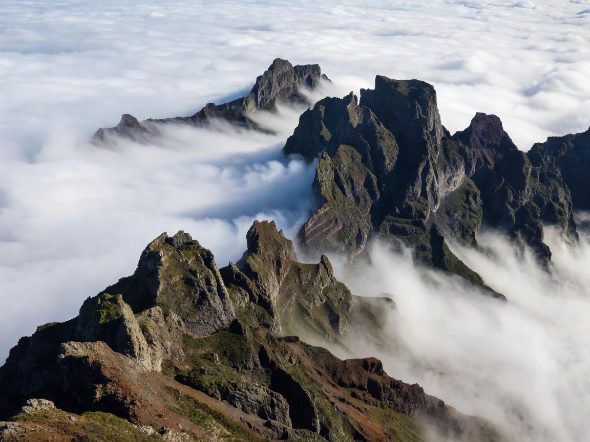
Comparative Topography: Shield Volcanoes vs. Caldera Lakes
While frequently grouped together as Portugal's Atlantic territories, Madeira and the Azores exhibit fundamentally different geological structures and landscape personalities:
Madeira: A deeply eroded volcanic shield rising sharply from an abyssal seabed over 4,000 meters deep. With peaks exceeding 1,860 meters (Pico Ruivo and Pico do Arieiro) compressed into an island only 57 kilometers long, vertical relief is extreme. Deep amphitheater canyons (ribeiras) plunge directly into Atlantic surf from dramatic vertical sea cliffs like Cabo Girão.
The Azores: An archipelago of nine islands scattered across 600 kilometers over the Mid-Atlantic Ridge triple junction. Azores landscapes are softer, defined by massive volcanic collapse calderas containing emerald and sapphire lakes (such as Sete Cidades and Lagoa do Fogo on São Miguel), active thermal fumaroles in Furnas, and the colossal, symmetrical stratovolcano of Mount Pico (2,351 m)—Portugal's highest point.
Madeira’s Levadas and Laurissilva Forest
Because Madeira’s moisture-bearing trade winds strike the northern slopes, historical settlers engineered over 2,000 kilometers of narrow stone and masonry water channels (levadas) to divert fresh mountain spring water across sheer precipices to the sunnier agricultural terraces in the south.
Today, the narrow maintenance paths flanking these channels provide some of the world's most dramatic hiking corridors. The Levada das 25 Fontes, Levada do Caldeirão Verde, and the mountain ridge traverse between Pico do Arieiro and Pico Ruivo pass directly through the UNESCO-protected Laurissilva forest—a prehistoric subtropical laurel forest that covered southern Europe prior to the last ice age.
"In the Azores, you stand atop the tectonic spine of the planet. In Madeira, you balance on a razor-thin stone channel carved into a 500-metre vertical basalt wall."
The Azorean Calderas & Geothermal Pulse
On São Miguel, the largest Azorean island, geothermal activity remains intensely present. In the Vale das Furnas, mineral-rich hot springs steam beside boiling mud pools (caldeiras), where locals bury pots in volcanic earth to slow-cook Cozido das Furnas using purely subterranean heat.
The western crater of Sete Cidades contains two interconnected lakes—one reflecting emerald green from surrounding pastoral and cryptomeria slopes, the other reflecting deep sky blue. Microclimates are variable; it is entirely customary to experience rain, sunshine, marine fog, and brilliant rainbow light within a single three-hour hiking loop.
Madeira Profile
- Year-round subtropical climate with mild winters.
- World-class engineering trails (levadas) with minimal slope along channels.
- Sophisticated culinary and hotel infrastructure centered in Funchal.
- High vertical drama suitable for serious mountain trekking.
Azores Profile
- More variable, oceanic weather requiring flexible daily schedules.
- Unrivaled geothermal thermal pools and crater lake vistas.
- World-renowned marine biodiversity for whale and dolphin watching.
- Requires inter-island flights (SATA Air Açores) or ferries to sample multiple islands.
Logistical Strategy for Atlantic Exploration
Never attempt to combine both archipelagos into a trip of less than 12 days. Both require separate flights from Lisbon or Porto (approximately 1.5 to 2.5 hours flight time).
For Madeira, renting a modern vehicle with adequate horsepower is essential to handle 25% road gradients leading up from Funchal to the central plateau (Paul da Serra). In the Azores, focus on one or two islands per week: São Miguel for volcanic calderas and geothermal springs, or the central triangle (Faial, Pico, and São Jorge) connected by short passenger ferry hops.